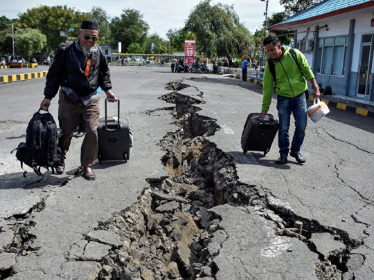
Earthquake 6.4 Magnitude Strikes Off Indonesia's West Timor - USGS

According to the US Geological Survey, an earthquake with a magnitude of 6.4 hit the eastern Indonesian province.
At the moment there are no reports of damage or casualties from the earthquake. The earthquake hit at a depth of 10 km about 100 km southeast of Kupang, capital of the province of East Nusa Tenggara.
#Earthquake M 6.2 - #TIMOR REGION, #INDONESIA - 2018-08-28 07:08:10 UTC pic.twitter.com/ua0lJHIBba
— Ditrianum (@ditrianum) August 28, 2018
6,2 earthquake in Timor Region using Earthquake App for iOS( https://t.co/S47wokDMwm) https://t.co/pvVjRK4qto pic.twitter.com/dDc7TPByZV
— Eric JF Kleijssen ???????????????? (@EricJFKleijssen) August 28, 2018
?On Sunday, Indonesia's Lombok island was hit by a 6.9-magnitude earthquake. The quake's epicenter was located at the depth of 10 kilometers.
Earlier in August, the island was hit by a 7.0-magnitude quake, reportedly claiming the lives of 436 people.
In 2004 a tsunami caused by a magnitude 9.3 earthquake off the coast of Sumatra in western Indonesia killed 220,000.
- Source : Sputnik News


